Hiking In
Shasta Lake
Shasta Lake, CA
HIKING

![]()
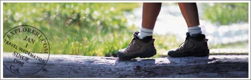
Shasta Lake Hiking & Nature Walks
Shasta Lake is home to a number of wonderful areas that are perfect for hiking and nature walks.
Featured Advertisers


Best Hikes and Backpacking on Shasta Lake
The Pacific Crest National Scenic Trail (PCT)
This Web site discusses the hiking and backpacking access points to the trail that extends from Canada to the Mexican border--a distance of 2,600 miles. Shows access points for Mt. Shasta hiking and backpacking.
The Trinity Alps Hiking and Backpacking Guide
Weaverville Ranger Station, P.O. Box 1190, Weaverville (530) 623-2121. The Trinity Alps are located South West of Mt Shasta.
This Web site dedicated to people who want to explore Mt. Shasta through long distance hiking and backpacking.
This Web site dedicated to those people who love Mt. Shasta but don't want to partake in long distance hiking and backpacking.
A good maps to use when hiking and backpacking in and around Mt. Shasta.
Mount Shasta Meditation Walks – PDF
Alpine Lakes of the Trinity Divide – PDF
Black Butte Trail (Mt. Shasta area) – PDF
Hayfork Area Trails – PDF
Pacific Crest Trail Access Points (McCloud area) – PDF
Pacific Crest Trail Access Points West of Interstate 5 – PDF
Mt. Shasta Day Hikes – Web
This Web site dedicated to those people who love Mt. Shasta but don't want to partake in long distance hiking and backpacking.
Shasta Lake Trails Guide – PDF
Sisson-Callahan National Recreation Trail (Mt. Shasta area) – PDF
South Fork National Recreation Trail (Platina area) – PDF
Squaw Valley Creek Trail (McCloud area) – PDF
Trail and Lake Information (Trinity Alps Wilderness) – PDF
Trinity Unit Trails Guide (Trinity, Lewiston Lakes area) – PDF
Upper McCloud River Area – PDF
You Can Report Trail Conditions – PDF
Samwel Cave - A Spelunker’s Guide
Shasta & Trinity Units • Whiskeytown - Shasta-Trinity National Recreation Area Shasta-Trinity National Forest
See also Parks and Forest Section
A good resource for Mt. Shasta hiking, backpacking, walking and day hikes.
Back >>