Reno
Campgrounds

![]()
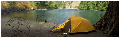
Reno Campgrounds and Camping
Our guide to Reno area camping can help you to quickly review the popular State Parks. Please select an area from the menu above or simply scroll down the page to view all of Reno, Sparks, and Carson CIty campgrounds.
To review our listings of Reno camping and campgrounds, please scroll down the page.
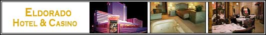
Featured Reno Resort
 Harrah's Reno Hotel & Casino - Book Online!
219 N. Center, Reno, NV
Harrah's Casino Hotel & Spa is conveniently close to the airport, near Reno City Hall, National Bowling Stadium, and the Pioneer Center for the Performing Arts. Also nearby are the National Automobile Museum and Nevada Museum of Art. The Hotel has a health club, an outdoor pool, and a fitness facility. 24-Hour Room Service Is Available!
Camping, Campsites, and Hiking
Bureau of Land Management — Carson City
5665 Morgan Mill Rd., Carson City, NV (775) 885-6000
Davis Creek Regional Park — 20 milees from Reno
West side of Washoe Valley, US 395 South District Ranger: (775) 849-0684
The park has 62 overnight campsites with a dump station available on a first-come, first-serve basis. Although there are no hook-ups, longer travel trailers can be accommodated at 19 sites. Hot showers are available year-round. Group camping and picnic facilities are available by reservation. Contact the park ranger for group camping reservations or our Parks Administration office for group picnic reservations. An equestrian trailhead provides access to the Toiyabe National Forest. .
Contact Parks Administration for group camping or group picnic
reservations at (775) 823-6501.
P.O. Box 1478 Dayton, NV (775) 687-5678
Picnicking, camping and group use facilities are available.
Fort Churchill is located along the Carson River, eight miles south of Silver Springs on US 95A. The park is situated 40 miles east of Carson City, and 36 miles west of Fallon.
More than 7,000 acres of public lands for public outdoor recreational use. Paved access is provided by Airport Road, off State Highway 89 midway between Woodfords and Markleeville, California.
Mt. Rose Campground – Park Closed for 2010 season for reconstruction
Mt. Rose Hwy (Hwy 431), South of Reno / Sparks, NV (775) 331-6444
The park is located at the top of Mount Rose summit in an alpine setting overlooking beautiful Lake Tahoe. Its campgrounds have 24 sites that can be used with tents or trailers up to 35 feet. Other features include: paved access road, paved campground road, drinking water, flush toilets.
Historic sites associated with the Pony Express, Transcontinental Telegraph, and Transcontinental Stage are located in the Carson City, Battle Mountain and Ely Districts. There are 30 original stations of which a handful remain standing. Sand Springs and Cold Springs are two of the well preserved stations. Sand Springs Station, adjacent to Sand Mountain Recreation Area has an interpretive trail as well. At Cold Springs Station an interpretive display on the Pony Express Trail is provided adjacent to Highway 50. A two-mile hike at the base of the scenic Desatoya Mountains provides access to the Cold Springs Pony Express Station. .
Located 70 miles north of Carson City via U.S. 395, the Pyramid Lake, one of the largest natural lakes in the state of Nevada . The lake activities include: picnicking, camping, boating, waterskiing, swimming, hiking, exploring, or just driving around.
Located in the high desert of west central Nevada, 25 miles east of Fallon, the sand dunes of the 4,795 acre recreation area provide challenge and excitement for many types of off-highway vehicle use. Primitive Camping Only.
Washoe Lake State Park between Carson City and Reno
4855 East Lake Blvd., Carson City, NV (775) 687-4319
Nestled in the heart of scenic Washoe Valley, visitors will find sweeping views of the Sierra Nevada and the Carson Range. Park activities include: nature study, bird watching, hiking, horseback riding, picnicking, windsurfing, water skiing, catamaran sailing, jet skiing and fishing.
A campground with forty-nine sites are open year round and available on a first come first serve basis. Several sites can hold RV's up to 45 feet in length. Sorry, no hookups. A dump station is available.
Other park features include: boat launches, group use area, day-use picnic sites and equestrian trailhead are also available.
Fort Churchill to Wellington Back Country Byway
Carson City BLM District Office, 1535 Hot Springs Road, Carson City, NV (702) 885-6000
Walker Lake Recreation Area -- Reno Camping
1535 Hot Springs Rd., #300, Carson City (775) 885-6000
One of two large natural lakes in Nevada, Walker Lake provides natural habitat for endangered Lahontan Cutthroat Trout. The 38,000 acre lake has a shoreline which varies from steep and rocky on the west side to fine white beaches on its eastern side. A boat ramp and primitive camping facilities are provided on the western shoreline along U.S. Hwy. 95. More from BLM > More form Public Lands>
Back To Top >>