Shasta Lake
Campgrounds
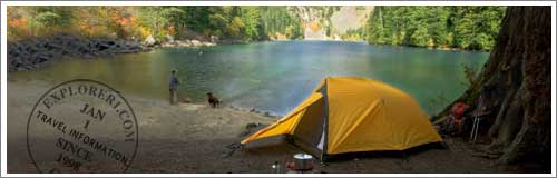
Shasta Lake, CA
CAMPGROUNDS

![]()
Hayfork Area Campgrounds and Camping
The large variety in terrain and ecosystems that exist on the South Fork Management Unit (SFMU) provide for a wide range of recreational opportunities.
The SFMU is based in Hayfork and contains the Hayfork and Hayfork Ranger Districts. The SFMU encompasses over 590,000 acres. Three major streams from the primary watersheds within this area; the South Fork of the Trinity River, Hayfork Creek and Beegum Creek.
The SFMU is bounded along its western side by South Fork Mountain, one of the longest continuous ridgelines in North America. At the southern end of the unit are the Yolla Bolla Mountains and one of two wilderness areas with the unit, the Hayfork/ Middle Eel Wilderness. Situated along the eastern side of the SFMU is the Chanchelulla Wilderness. The northern end of the unit is bounded by a series of ridgelines and peaks that include Pattison Peak, Hayfork Bally and Hayfork Divide.
The Chanchelulla Wilderness is the second of the two wilderness areas in the South Fork Management Unit, which provides opportunity for wilderness hiking and camping.
The South Fork of the Trinity is a rich resource with its serene beauty and its many recreational opportunities.
The large variety in terrain and ecosystems that exist in this area provides for a wide range of recreational opportunities. From old historic Ranger Station Cabin Rentals, developed tent / RV campsite facilities with running water and toilets, to tent camping at various undeveloped sites, all the way to true wilderness in two wilderness areas, a 40+ mile wild and scenic river corridor or numerous roadless areas. With this wide range of recreational opportunities, you should be able to find just the right one for your interests.
Hayfork Ranger Station
P.O. Box 400, Platina, CA 96076 (530) 352-4211
Featured Advertisers


Hayfork
Camping, Campsites, Day Use and Hiking
Campground Camping Areas
The park's campground has 8 campsites. No RVs. No piped water.
The park's campground has 15 campsites and it can accommodate RVs up to 15' long. Fresh water is available. It is also wheelchair accessible.
The park's campground has 17 campsites and it can accommodate RVs up to 15' long. Other park features include beach area, fresh water, and it is wheelchair accessible.
There are 6 tent only camping units. No water system and unpaved access to the facility. Hiking access for the Philpot Interpretive Trail.
The park's campground has 10 campsites and it can accommodate RVs up to 20' long. It has a beach area, and it has 10 picnic units. Access is by unpaved road.
Campground offers 5 tent only camp units and 2 picnic units. Access to facility if unpaved and there is no water system. Access from facility to the Chanchelulla Wilderness.
Slide Creek Campground is has 5 tent only camp units. There is no water system.
Little Rock Picnic Area -- Hayfork Day Use Area.
No Campgrounds The area has 2 picnic areas and a beach area. No water. No campsites.
Natural Bridge Picnic Area -- Hayfork Day Use Area.
No Campgrounds This historic site has two available picnic areas. No RVs. No campsites. Access is by unpaved road.
Dispersed Camping
Areas for Dispersed Camping at Hayfork Area
Features rugged terrain with steep, chaparral and tree covered slopes. Chanchelulla Peak is the highest point at 6,400 feet.
Back To Top >>